
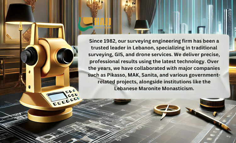
HAJJ SURVEY TEAM
since 1982
Professional surveying Engineer
know the difference
EXPLORE OUR SERVICES
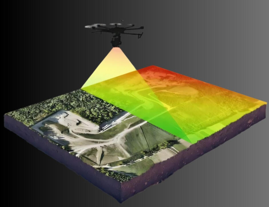
Surface Element Topographic Survey
A specialized topographic survey focused on capturing and mapping all visible, immovable elements on the land surface — including buildings, vegetation, walls, and infrastructure — with precise geospatial accuracy.
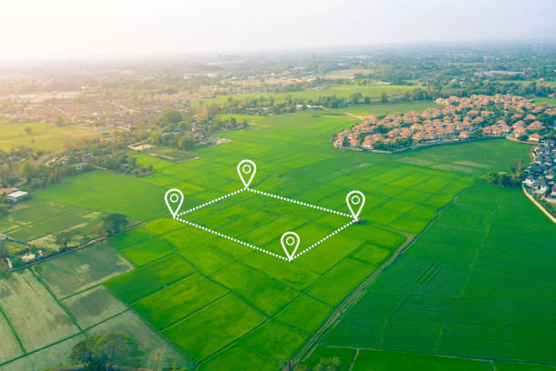
Marking Parcel Boundaries
A simple way to bring clarity to your land, by making its limits easy to recognize on site.
Elevation & Contour Surface Survey
A precise drone-acquired survey that delivers elevation data and contour lines essential for topographic planning and land development.
3D Mapping and Modeling
High-quality 3D models for seamless project visualization and decision-making.

Geographic Information Systems (GIS)
We deliver GIS solutions built for surveying engineering — combining drone data, GPS, and mapping tools to support land development, infrastructure planning, and cadastral documentation.
ABOUT U S
Meet our department leaders
Our team of expert department leaders brings years of experience and specialized knowledge to every project. With a commitment to excellence, they oversee operations, ensure the highest standards, and drive innovation across all aspects of our surveying services.
Antoine El Hajj

Owner and founder
With over 40 years of experience, Antoine El Hajj is an expert in all aspects of surveying. His extensive knowledge and dedication to quality have been pivotal in establishing the firm as a leader in the industry.
Serge El Hajj

Head of Drone Operations
With over 5 years in surveying and close to 3000 Km of drone flight experience, Serge El Hajj leads our drone operations, bringing specialized expertise in both drone technology and program management.

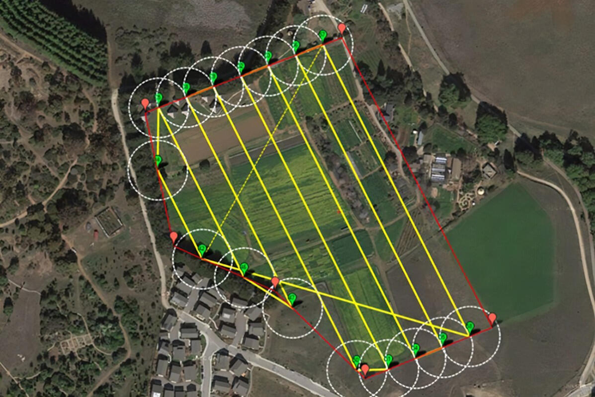
Aerial Topographic Surveys
Purpose:
Focuses on capturing and mapping visible, permanent land surface elements such as buildings, vegetation, walls, roads, and existing infrastructure with precise geospatial accuracy.Data Collected:
Building outlines, trees and vegetation, walls, fences, roads, utilities, infrastructure elements, surface features, levels, contours, and key site details.Deliverables:
A complete 2D and 3D Civil 3D DWG map, supported by a clear PDF version for fast viewing, simple sharing, and easy access.
Is This the Solution You’re Looking For?
3D Mapping and Modeling
Using state-of-the-art drone technology, we capture detailed aerial data to create accurate 3D models and maps. Perfect for site analysis, urban planning, and infrastructure projects, our process ensures precision and clarity every step of the way.
Is This the Solution You’re Looking For?
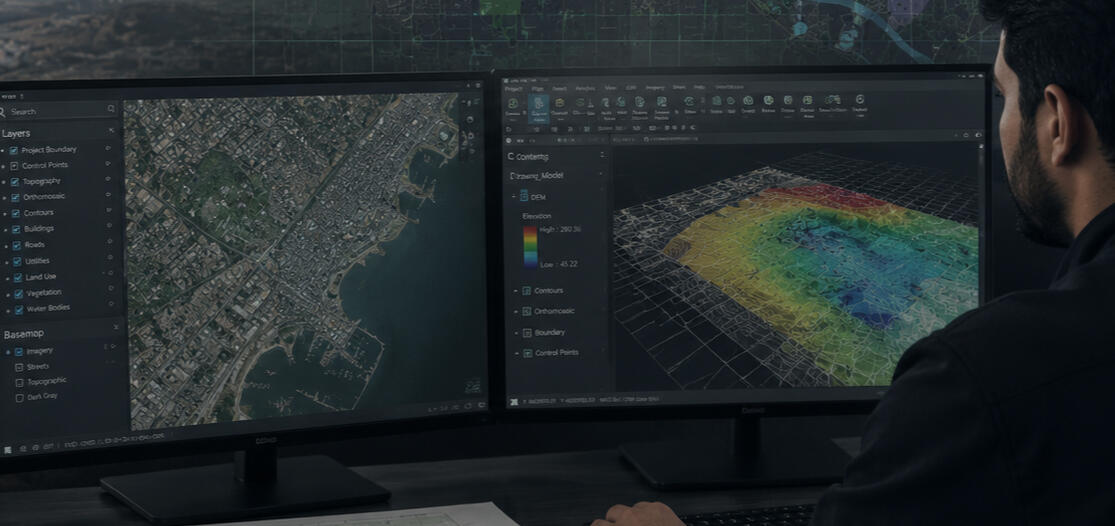
Elevation & Contour Surface Survey
Purpose:
Captures detailed elevation data and generates high-accuracy contour lines to represent landform changes. Ideal for grading design, drainage planning, slope analysis, infrastructure layout, and topographic engineering.Data Collected:
Elevation points, breaklines, terrain profiles, slope variations, and ground surface geometry.Deliverables:
Digital elevation models (DEM), contour maps, cross-sections, topographic plans, and CAD-ready terrain surfaces.
Is This the Solution You’re Looking For?
| type | Best for | Accuracy | Image Resolution | Project Deliverables |
|---|---|---|---|---|
| Oblique | High-detail 3D modeling / Buildings & infrastructure / Complex structures / Urban planning / Construction & engineering / Real estate visualization. | 1-3 cm with RTK & proper overlap settings (depends on altitude and flight parameters). | ~0.8-1 cm/px (varies based on altitude and camera settings). | ✅3D Mesh Model (for visualization & BIM) ✅ Point Cloud (for CAD & GIS work) ✅ Textured 3D Model (for digital twins & VR applications) ✅Orthomosaic Map (for large-scale mapping) |
| Smart oblique | High-accuracy 3D modeling / City-scale mapping / Large-area urban planning / Building facades & rooftops / Surveying complex structures / Digital twin creation | 1-3 cm with RTK (depends on altitude & overlap settings) | ~0.8-1 cm/px (varies based on altitude and camera settings) | ✅ High-resolution 3D Mesh Model✅ Point Cloud (LAS/LAZ format)✅ Textured 3D Model✅ Orthomosaic Map✅ Building Facade Data |
| Geometric | Topographic mapping / Large-scale land surveys / Agricultural fields / Mining sites / Powerline & infrastructure inspections / Land contour mapping | 1-2 cm with RTK (depends on altitude & overlap settings) | 1-3 cm/px (varies based on altitude and camera settings) | ✅ Digital Elevation Model (DEM)✅ Point Cloud (LAS/LAZ format)✅ Orthomosaic Map✅ Contour Map✅ 3D Model for Volume Calculation |
| Slope | Terrain mapping / Slope analysis for construction projects / Landslides & flood risk assessments / Agricultural field modeling / Environmental & forestry surveys / Road and railway design | 1-2 cm with RTK (depends on altitude & overlap settings) | 0.3 - 3 cm/px (varies based on altitude and camera settings) | ✅ Digital Terrain Model (DTM)✅ Point Cloud (LAS/LAZ format)✅ Orthomosaic Map✅ Slope Analysis Map✅ Contour Map✅ Volume Calculation Models |
| service | purpose |
|---|---|
| Utility & Infrastructure Mapping | Locate and map visible infrastructure (roads, poles, pipelines). |
| Topographic Layer Integration | Overlay contours, elevation, and terrain data for planning. |
| Land Division & Subdivision Mapping | Design and visualize parcel splits for land development. |
| Construction Progress Mapping | Visual tracking of site changes over time. |
| Road & Network Alignment Mapping | Plan and adjust infrastructure layout with terrain and boundary data. |
Is This the Solution You’re Looking For?
1-Advanced Aerial Surveying with the DJI Matrice 4E
2-Moving Forward Through Every Challenge

* Despite the ongoing economic crisis and regional instability, Hajj Survey Team continues to invest in progress, professional development, and advanced surveying technologies.Our team has completed specialized training and certifications in drone safety, advanced aerial photogrammetry, PointCab and PointSense point-cloud processing, and commercial drone operations.These continuous investments allow us to maintain high professional standards, adopt modern workflows, and provide our clients with safer, faster, and more accurate surveying solutions.
3-Expanding Our Services

* Since the end of 2022, Hajj Survey Team has expanded its services through professional drone imagery and GIS-based surveying. Starting with the DJI Mavic 3 Enterprise, we strengthened our aerial mapping, topographic, and spatial-data capabilities through major projects.Today, we continue that progress with the DJI Matrice 4E, bringing improved performance, advanced imaging, and AI-assisted workflows to our surveying operations.